2.4 — Soil diversity across land covers
Peat cover stories
Page 4 / 5
Peatlands in the Netherlands
Based on the peatland map of Europe, we know that approximately 7,3% of the Netherlands is currently covered by peat. But where exactly is peat found in the Dutch landscape?
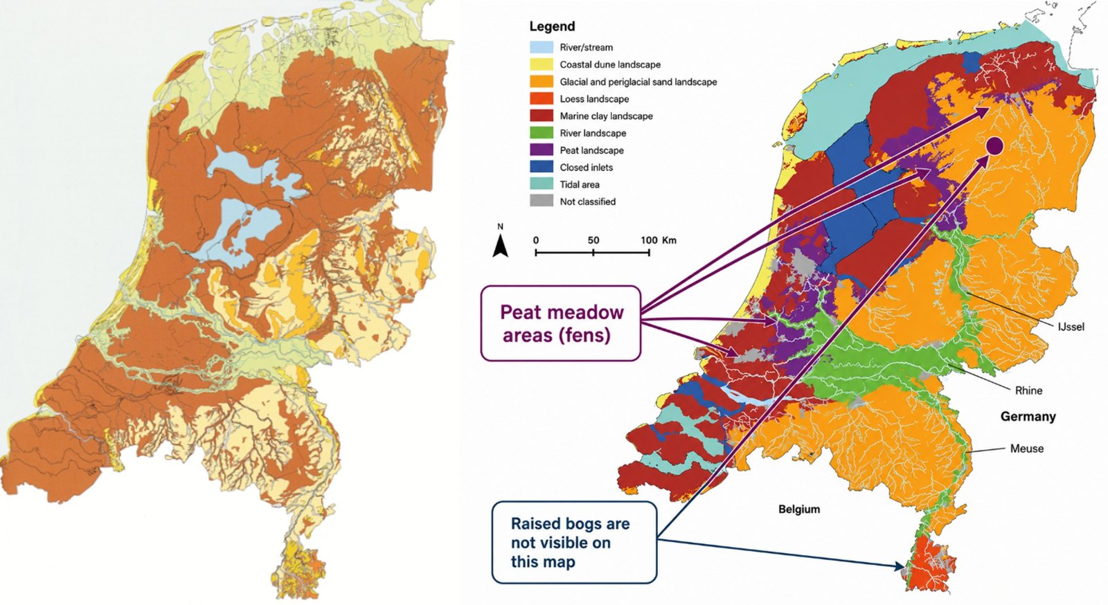
Left: Paleo-geographic map of the Netherlands, 2500 BP (before present). Source: Landschappen van Nederland (2014).
Right: Physical geographical regions of the Netherlands. Source: Atlas Natuurlijk Kapitaal..
The map on the right, showing the physical geographical regions of the Netherlands, helps answer this question. The purple areas indicate peat landscapes, which are concentrated mainly in the north and west of the country and are commonly known as peat meadow areas. Peat is also found in the stream valleys within the sandy regions and occurs as raised bogs in several Natura 2000 areas. The arrows on the map indicate some of the major peatland areas in the Netherlands. Most Natura 2000 areas, however, are too small to be visible on this map.
Although “only” 7,3% of the Netherlands is now covered by peat, peat remains a defining feature of the Dutch landscape and cultural history. Think of the Dutch windmills, a national symbol, which were used for centuries to drain peat meadow areas (see photo on the left below). Another characteristic feature is the cope parcellation pattern (cope-ontginning): a landscape divided into long, narrow, regularly shaped parcels (see photo on the right below). Developed between the 10th and 13th centuries, this highly regulated system of land reclamation transformed vast, densely forested wetlands into habitable and productive agricultural polders.
The importance of peat in the Netherlands becomes even clearer when we look back in time. During the Iron Age, around 2,500 years ago, more than half of the country was covered by extensive, largely pristine peatlands (see the paleogeographic map on the left). It is estimated that approximately 1 million hectares of bogland existed at that time, covering about 30% of the present-day land area. Over the following centuries, much of this peat disappeared through a combination of natural and human-driven processes, including coastal erosion, marine clay deposition, flooding, sea-level rise, drainage-induced compaction and oxidation, and peat extraction.
By the second half of the Middle Ages, around 250.000 hectares of bogland remained, mainly in the eastern and southern Netherlands. Since then, most of these areas have been drained or excavated and converted to agricultural land. Today, less than 1% of the original bogland area survives, amounting to only about 8,000 hectares (compared with the original bogland area during the Iron Age, around 2,500 years ago). The rise and decline of Dutch peatlands forms one of the most fascinating chapters in the history of the Netherlands’ soils and landscapes. If you would like to learn more about this story, skip ahead to Module 3, “Peatland degradation”.
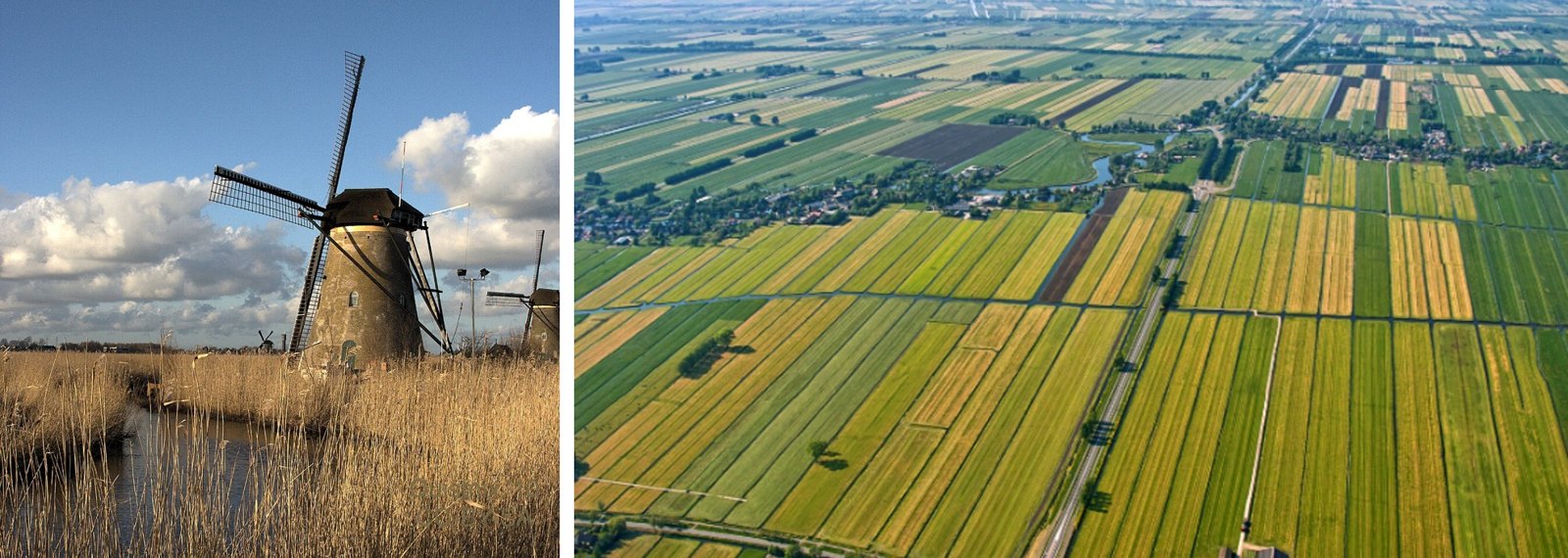
Left: © Kinderdijk – Molen Nederwaard, windmill, by Quistnix, CC BY 3.0, no changes were made to the original photo.
Right: Characteristic cope parcellation pattern in the Alblasserwaard, the Netherlands. The dimensions of the strips were exactly 1250 m x 115 m. Source: Landschappen van Nederland (2014).