2.4 — Soil diversity across land covers
Peat cover stories
Page 2 / 5
Peatlands around the world
To address this information gap, the Global Peatland Map 2.0 was produced for the Global Peatland Assessment, providing the most up-to-date global dataset on peatland distribution and extent. Covering all regions of the world, it helps decision-makers identify priority areas for conservation, restoration, and sustainable management. The map also presents ‘probable’ peatlands, i.e. areas that show peatland characteristics in remote sensing data but have not yet been confirmed through field measurements.
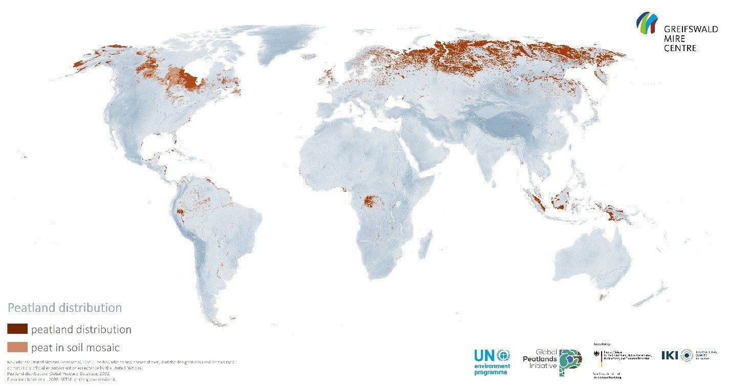
The global peatland map 2.0 (GPM2.0).
DID YOU KNOW THAT …
- peatlands cover only 3-4% of the Earth’s surface, yet they store nearly 30% of the world’s carbon stock?
- peatlands contain around 10% of global freshwater resources?
- peatlands act like natural sponges, regulating water by storing it, slowing its movement, and releasing it gradually, reducing flood risk and increasing resilience to drought?
- degraded peatlands contribute at least 4% of annual human-caused greenhouse gas emissions worldwide?
- peatlands are disappearing three times faster than forests globally?
- around 87% of the world’s peatlands remain mostly in a natural state - meaning there is still a huge opportunity to protect them?
- peatlands are found on every continent, from the Arctic to tropical rainforests and even mountainous regions?
- scientists use satellites, drones, radar, LiDAR, and machine learning to map peatlands and monitor their condition?
- peat thickness is extremely difficult to measure remotely, making peatland mapping one of the biggest challenges in environmental science?
- disturbances to peatlands in the Peruvian Amazon have released more than twice Peru’s annual fossil fuel and industrial carbon emissions in some years?
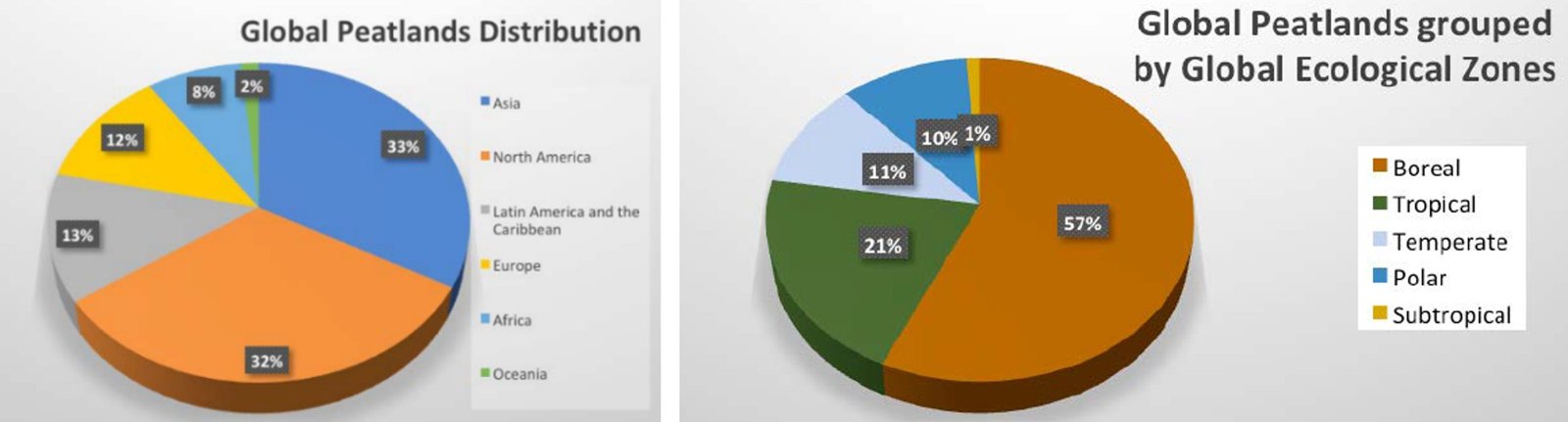
Left: Proportional distribution of peatlands (including probable peatlands) over the various continents/regions.
Right: Distribution of peatlands (including probable peatlands) over the various Global Ecological Zones.